Growing interest in restoring the natural cycling of water

Australia is the driest continent on earth and the management of our water assets is often the limiting factor to the productivity and viability of our farmland.

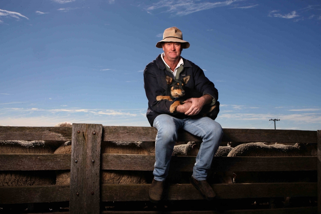
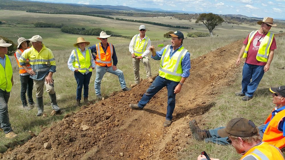
Capertee Valley Landcare are celebrating a year of water in the valley with a series of activities and events focusing on re-hydrating the landscape. They will be hosting a 4-day workshop on Restoring Natural Landscape Function in Glen Alice in March.

Growing interest in restoring the natural cycling of water and improving resilience have led a number of landholders in the valley to explore the technique of Natural Sequence Farming. The hands-on training course will be delivered by Stuart Andrews, Tarwyn Park Training, and will focus on on redesigning your farm through Natural Sequence Farming techniques and principles to maximise productivity, enhance landscape function and minimise farm costs.

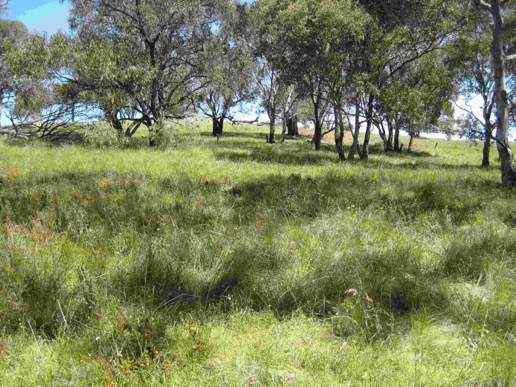
Natural Sequence Farming is an agricultural practice developed by Peter Andrews which aims to re-establish the natural function, fertility and resilience of agricultural landscapes. One of its primary aims, and main benefits, is a landscape that harvests more water, holds more water, and uses available water more effectively, resulting in increased primary production.

Stuart Andrews will present the 4 day hands-on workshop on restoring landscape function.

Rather than allowing water to flow straight downhill, Natural Sequence Farming utilises plants and gravity to slow down the flow of water, move the water through the landscape and give soils, the largest water sinks on our farms, time to recharge.

Although simple in principle, the technique relies on knowledge and skills to read the unique Australian landscape. Each of the four days during the course will focus on a key step in restoring natural functions; day 1 – slow the flow, day 2 – let all plants grow, day 3 – careful where the animals go, day 4 – to filter the flow is a must know.

Participants will learn how to read the landscape; rehydrate the landscape; fully utilise your farm’s natural resources; locate, design and build natural landscape structures; redesign your property; begin improving landscape function; and lower farm costs and boost profits.

The 4 day course will run from Monday, 23 March to Thursday, 26 March at a cost of $2,450 (inc. GST) per person.

For more information or to book visit: www.tarwynparktraining.com.au. For enquiries email: info@tarwynparktraining.com.au.

Local landholder to trial multi-species crop to improve livestock performance through winter

In our climate, the cold temperatures experienced over the winter months are the principal factor affecting pasture growth and can result in a winter feed gap. What if you could supplement livestock nutrition by providing additional fodder while improving soil structure and nutrient cycling and build soil carbon at the same time?

In collaboration with farmer, Colin Seis, Watershed Landcare have launched a project to demonstrate and research the benefits of multispecies forage crops for increased animal performance and soil health. As part of their community focused Australian Good Meat initiative, Meat & Lifestock Australia (MLA) in partnership with Landcare Australia have funded the trial site through the MLA Landcare Excellence in Sustainable Farming Grants.

The project will build on growing evidence from the USA and Australia which has shown that multispecies crops and pasture diversity will increase soil carbon, nutrient cycling, and improve soil biology and farm ecosystems.

The project will be carried out at ‘Winona’, 20 km north of Gulgong NSW. ‘Winona’ consists of 840 ha of restored native pasture which runs 4000 merino sheep for wool, merino lamb, and mutton production.

Colin Seis will establish a trail site to demonstrate the benefits of multispecies forage crops for increased animal performance and soil health.

The project will zero till a multispecies mix forage crop into a dormant native grassland. A mix of up to 10 species in a multispecies crop with its diverse mix of plant roots and flowering plants aims to build soil carbon and biology which cycles nutrients. An adjacent area (paddock division) will be sown to a single species fodder crop as a comparison. The project and control paddocks will be used to fatten and finish merino lambs, with weight increases in the sheep periodically monitored over the course of the trial. Changes in soil carbon, soil structure and chemistry and grassland species will be monitored pre-sowing and post-grazing.

Multispecies pasture cropping has multiple benefits for livestock producers. It provides a viable farm adaptation to reduced and changing rainfall events; by sowing an opportunity crop to provide high quality livestock feed while reducing financial risk.

Besides increasing livestock performance, and so farm profitability and sustainability, multispecies pasture crops have long-term benefits for soil nutrient cycling, biology, pasture productivity and increase soil carbon sequestration which can offset livestock emissions.

Additionally, pasture management over the entire property can be improved during the winter feed gap. By establishing a multi-species autumn crop and providing additional fodder through winter, pasture rest times can be maintained and overgrazing prevented on adjacent paddocks; improving future growth rates of pastures, reducing bare ground, and reducing weed invasion whilst maintaining stock health.

The project will gather data of lamb performance (weight gain), crop biomass, pasture species composition, and soil chemistry and structure, providing objective data evidence of this practice.

The trial will continue until 2024 by sowing a diverse multi-species forage crop on the same area and monitoring the changes in soil carbon and nutrient cycling over a longer time frame.

Landholder incentives to enhance Box Gum Grassy Woodlands

Box Gum Grassy Woodlands were once widespread along the western slopes and tablelands of the Great Dividing Range. Today less than 4% of this ecological community remains.

This endangered ecological community is closely associated with fertile clay loam soils of moderate depth on flat to undulating terrain. Within the Watershed Landcare region they occur mainly in areas with a 550 mm to 800 mm annual rainfall and an elevation below about 700 m above sea level.

Box Gum Grassy Woodlands are dominated by the eucalypts White Box, Yellow Box and/or Blakely’s Red Gum and are characterised by their understory; a sparse shrub layer and a diverse mix of native grasses and herbs.

Trees provide many valuable ecosystem services to productive systems, such as improved soil structure and fertility, shade and shelter for livestock and reduced soil moisture loss. They also serve as wildlife corridors, providing stepping stones for animals between foraging and nesting sites and water sources. This will become increasingly important as the habitat ranges of our native fauna shift as the climate continues to change.

Watershed Landcare have incentive funding available for landholders to conduct on-ground works to increase the extent or quality of Box Gum Grassy Woodland on the land they manage. As part of the Patches and Paths project, $7000 in funding is available each year until 2022.

Project funding can be utilised to contribute to materials and/or labour. Eligible activities include:

  • fencing around mature, isolated paddock trees and remnant native vegetation clusters
  • fencing to enable changed grazing management intended to allow natural regeneration of woodland vegetation species
  • in-fill planting, especially to increase diversity of understory species
  • revegetation activities to improve landscape connectivity
  • any other activities that protect or enhance White Box, Yellow Box, Blakely’s Red Gum Grassy Box Woodland and Derived Grassland, especially novel and innovative approaches

Applications for staged projects will be supported. For example you can apply for a 3 year project to conduct fencing in year 1, site preparation in year 2 and in-fill planting in year 3.

Expressions of Interest (EOI) for the Patches and Paths project are now open to landholders in the Watershed Landcare region. More information about the project is available on our website: http://watershedlandcare.com.au/projects/patches-paths/

Not sure if you have White Box, Yellow Box and/or Blakely’s Red Gum on your place? Give us a call, Watershed Landcare’s resident botanist is happy to help.

If you don’t have Box Gum Grassy Woodland tree species on your place but there are remnants on the roadside corridor or a neighbouring property you may still be eligible to conduct revegetation activities to improve landscape connectivity.

If you would like to discuss your individual situation or project idea contact our coordinator, Agness Knapik: info@watershedlandcare.com.au or 0435 055 493.

Help contribute to bushfire recovery science

The 2019-20 summer saw unprecedented bushfire activity in eastern Australia, making headline news around the globe. With the bushfire season not over, and fires still active in many areas, the full extent of the damage and cost to people, property, livestock and the natural environment may not be known for many months.

The sheer extent of the fires and the impacts on our community have left many of us feeling helpless. A recently launched citizen science project is providing an opportunity for people to make a positive contribution to post-bushfire efforts.

A group of researchers from the Centre of Ecosystem Science at the University of NSW are trying to understand how the environment recovers from this unprecedented fire season through the Environment Recovery Project: Australian Bushfires initiative. And they need your help to collect species recovery data to advance this important scientific goal.


Image credit: Casey Kirchhoff

“We will use people’s observations for future research into understanding how some areas recover better than others, and in different places, as well as understanding which animals and plants come back first,” Professor Richard Kingsford, Director of the UNSW Centre for Ecosystem Science, said.

“The key aims of this initiative are to understand which plant species are resprouting and growing seedlings, to calculate when and how animals return to burnt areas, and to highlight which species are struggling to recover and might need our help.

“Understanding recovery from this unprecedented fire season is scientifically critical and the opportunity to harness the community’s resources through the Environment Recovery Project is a practical way of doing this.”

Many temperature records were broken this summer and Australia’s climate is going to continue to get hotter and drier, contributing to more frequent and more intense bushfires.

Observations from the Environment Recovery Project will build a picture of when, where and how Australia’s ecosystems recover from these fires, which will inform future research. Participation from the public means that many observations, from an extensive area can be collected, something that would be impossible with the resources available to scientists alone.

Providing it’s safe to do so, take a walk in areas of burnt bushland. But please be aware of current weather conditions and fire danger ratings. Never enter areas where there is active fire. Many bushfire impacted communities are still grieving, please be respectful of their privacy. Do not trespass private property. Always stay on designated walking trails and do not trample recovering biodiversity.

Image credit: Casey Kirchhoff

To contribute simply download the mobile app (available from: https://www.inaturalist.org/projects/environment-recovery-project-australian-bushfires-2019-2020) and take some photos with your phone:

  • Plants (native and weeds): Seedling or resprout
  • Animals (natives and ferals): Alive or dead, tracks and scats
  • Fungi and Lichen
  • Landscapes: Photos that capture scorch height (how high the fires went) or the extent of leaves lost up to the canopy

Observations of common species are just as important as rare species.