Pitch in and help clean up the wetlands

Sunday 5 March is Clean Up Australia Day. Now in it’s 27th year, this simple idea has become the nation’s largest community-based environmental event.

The Friends of Putta Bucca Wetlands are inviting members of the community to help them clean up, fix up and conserve the environment of the Putta Bucca Wetlands.

The public reserve is managed by Mid-Western Regional Council and it’s main attraction is a large disused gravel quarry containing freshwater that seeps in through alluvial aquifers from the Cudgegong River. The quarry now function as as an oxbow lake (billabong) wetland supporting a highly biodiverse wetland ecosystem.

The fluctuating water level, periodic mudflats and abundance of snags and water plants contribute the vital habitat for a high diversity of waterbirds, frogs, fish, and turtles. A number of mammals also inhabit the wetland, including the platypus.

The wetland is also an important breeding site for many birds such as the rainbow bee-eater. Over 150 bird species have been documented at the site.

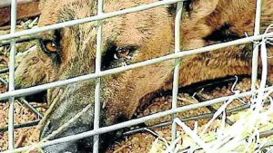
Rubbish is not only unsightly but can also harm the birds and animals that make the wetland their home.

Animals can become trapped or tangled in bottles, cans, plastic bags and other packaging. This can result in injury or even cause them to drown. Ingesting plastic can also have devastating effects.

Rubbish can also harm or kill wildlife indirectly, chemicals leaching form rubbish can impact on water quality or introduce toxic compounds into the environment.

Why not come along and do your bit to conserve the biodiversity in this little piece of wilderness right in Mudgee’s backyard?

The Clean Up Australia Day event at the Putta Bucca Wetland, Putta Bucca Rd, will be held on Sunday 5 March. We will meet in the car park at 9am and finish around noon.

Fully covered shoes or boots are essential. Please also bring gloves, hat and drinking water. Children are welcome but must be accompanied by a responsible adult.

For more information contact John McCrea jsmccrea@hwy.com.au.

Mobile phone App to map wild dogs

Wild dogs are not only a threat to native wildlife but also generate significant losses for primary producers; direct impacts such as killing and maiming stock, as well as the time and resources invested into control strategies, affect operational costs.

Landholders have a new tool available for use in their wild dog control toolkit, they can now access WildDogScan with their mobile phones to record wild dog data while in the field.

The new, easy to use website and Phone App (free for Apple and Android devices) was designed by landholders and enables iPhone, Android and iPad users to record sightings using their mobile phone. It also allows users to examine wild dog data throughout their local area.
Watershed Landcare spoke to FeralScan Project Coordinator, Peter West, to find out how landholders can utilise the new resource to aid in wild dog management.

“We are trying to encourage people to document wild dog activity in their local area and over time see a regional picture emerge in regards to wild dog movement, behaviour and timing of problems.” said Mr West.

“Wild dog research suggests that there are patterns in activity and we are hoping that providing farmers with a tool to easily record wild dog activity will help them to build a picture of wild dog activity for their entire region, and that this helps all landholders in a region to improve wild dog management by reducing costs and increasing benefits.” he continued.

The WildDogScan Mobile Mapping Facility allows landholders to:

  • record wild dog sightings, their damage and control activities,
  • use the data from their local area to create and print a map,
  • identify the priority areas for control on their property and local area,
  • link with neighbours and local groups and coordinate resources,
  • monitor the effects of control programs and improve their effectiveness,
  • review the map to see changes over time,
  • inform their community about wild dog problems.

“An added benefit is that it will help landholders and biosecurity staff connect. Key Local Land Services biosecurity staff can be notified of wild dog activity as it is recorded to keep everyone in the picture about current wild dog problems.” said Mr West.

Visit www.feralscan.org.au with your mobile phone or download the free FeralScan App to get full use out of the WildDogScan mapping service.
Landholders who would like more information about WildDogScan can contact Peter West on 6391 3887 or by email peter.west@dpi.nsw.gov.au, or contact the NSW Local Land Services.

Buzzing with Landcare

Are you interested in learning about bees, or perhaps having your own hive but don’t know where to start?

Read more